I had a lovely sleep and slept later than usual waking up at almost 7:00. It was beautifully quiet in the tiny hamlet of Stonethwaite. Just heard birds singing and the baaing of sheep in the fields.
Stonethwaite Farm our B & B
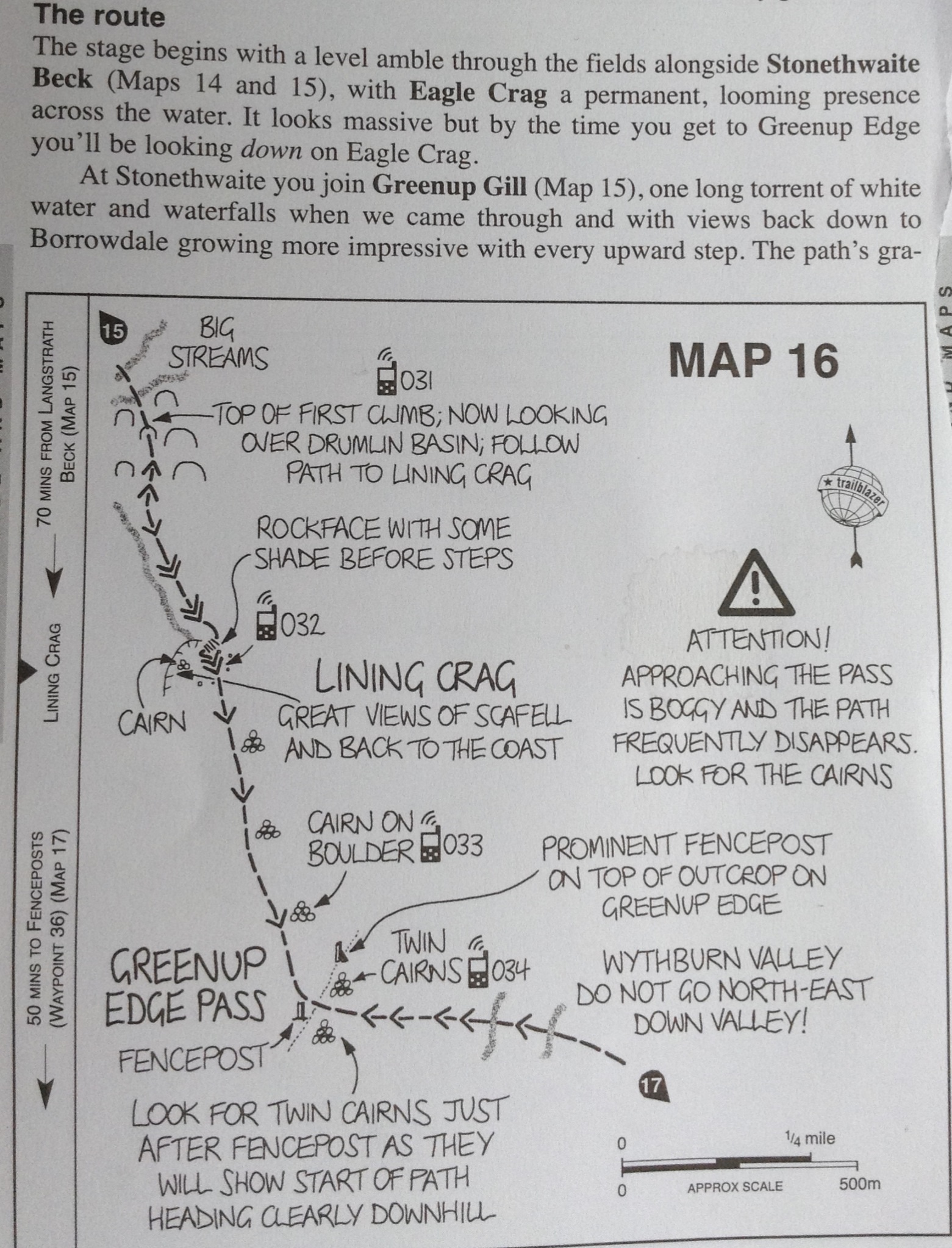
This was suppose to be our route.
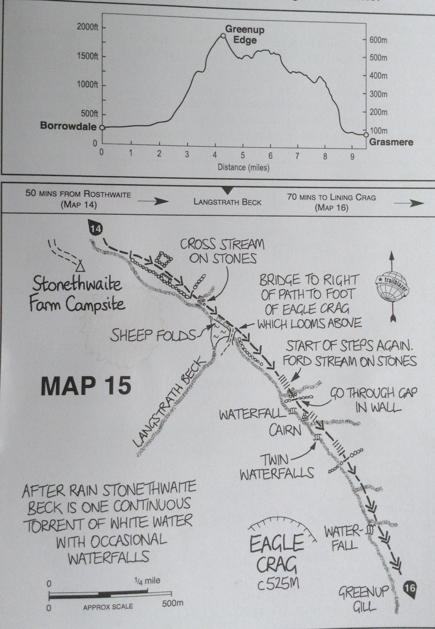
According to the guide book it begins “with a level amble through the fields along Stonethwaite”, but that is not how it started for us…mores the pity.
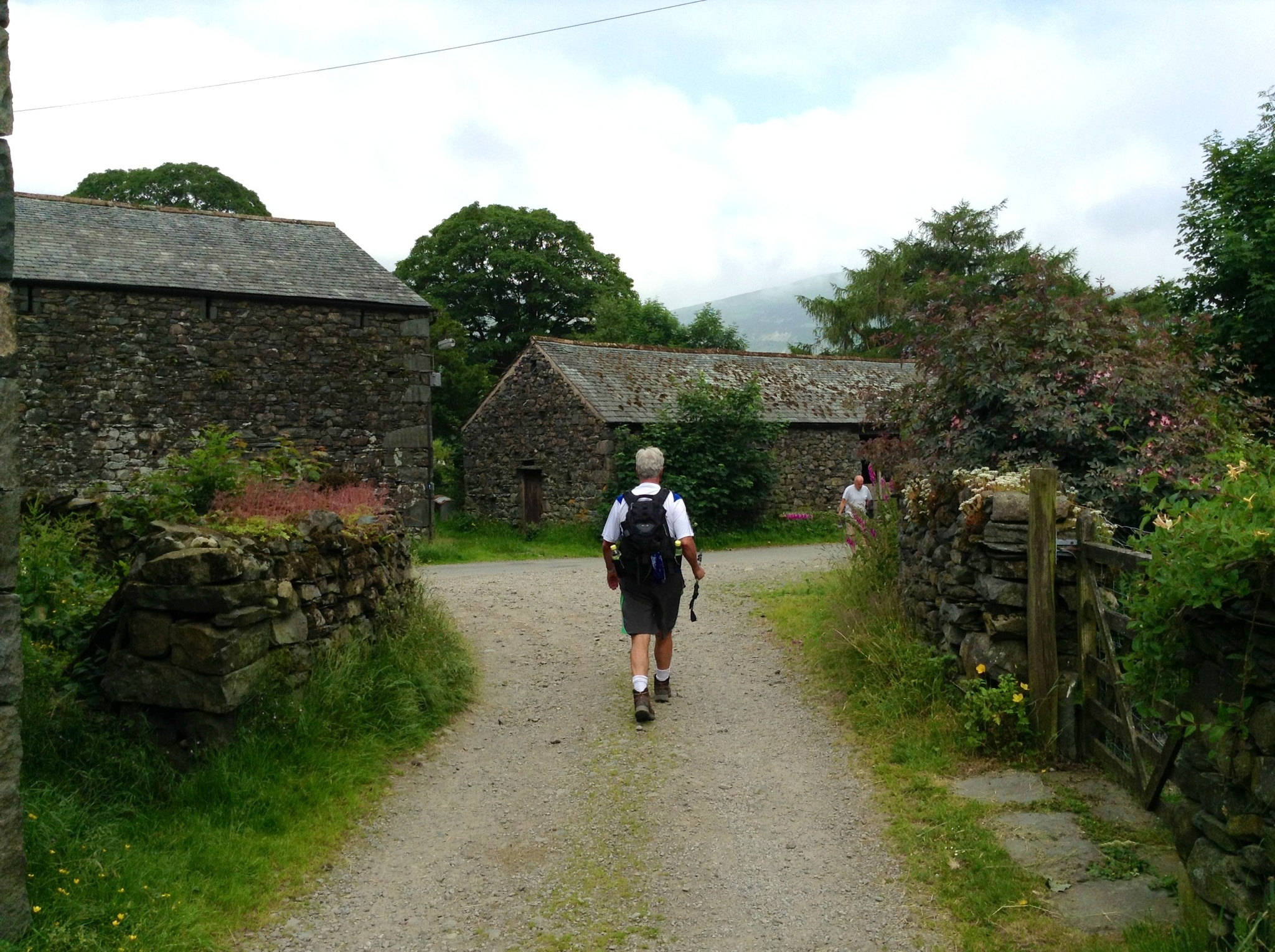
Tony leaving Stoñethwaite Farm never realizing the immediate danger ahead
We walked down the lane to where the path begins. I saw the signpost that said Grasmere and pointed to a level but gravel strewn lane alongside some sheep pasture. Tony saw a yellow arrow that pointed toward a godawful, steep, rocky, narrow, path that headed straight up. This is the way he said positively. I commented on the signpost that directed us the other way. i guess he wanted to get the horrid climb out of the way, or those of you that know Tony realize he is not one to take the easier safer route. Up we went, endlessly. I had sweat pouring into my eyes, heat and terror does that to me. In some parts I had to scramble on my hands and feet up masses of rocks which in many places resemble steps, but in others, not so much.
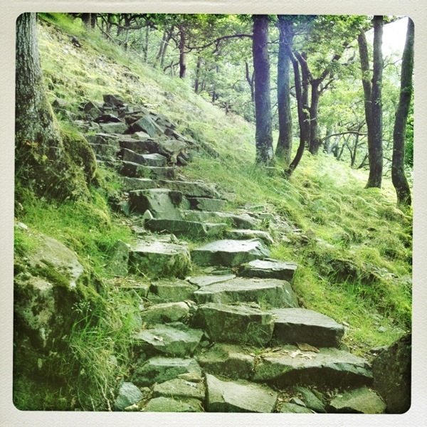
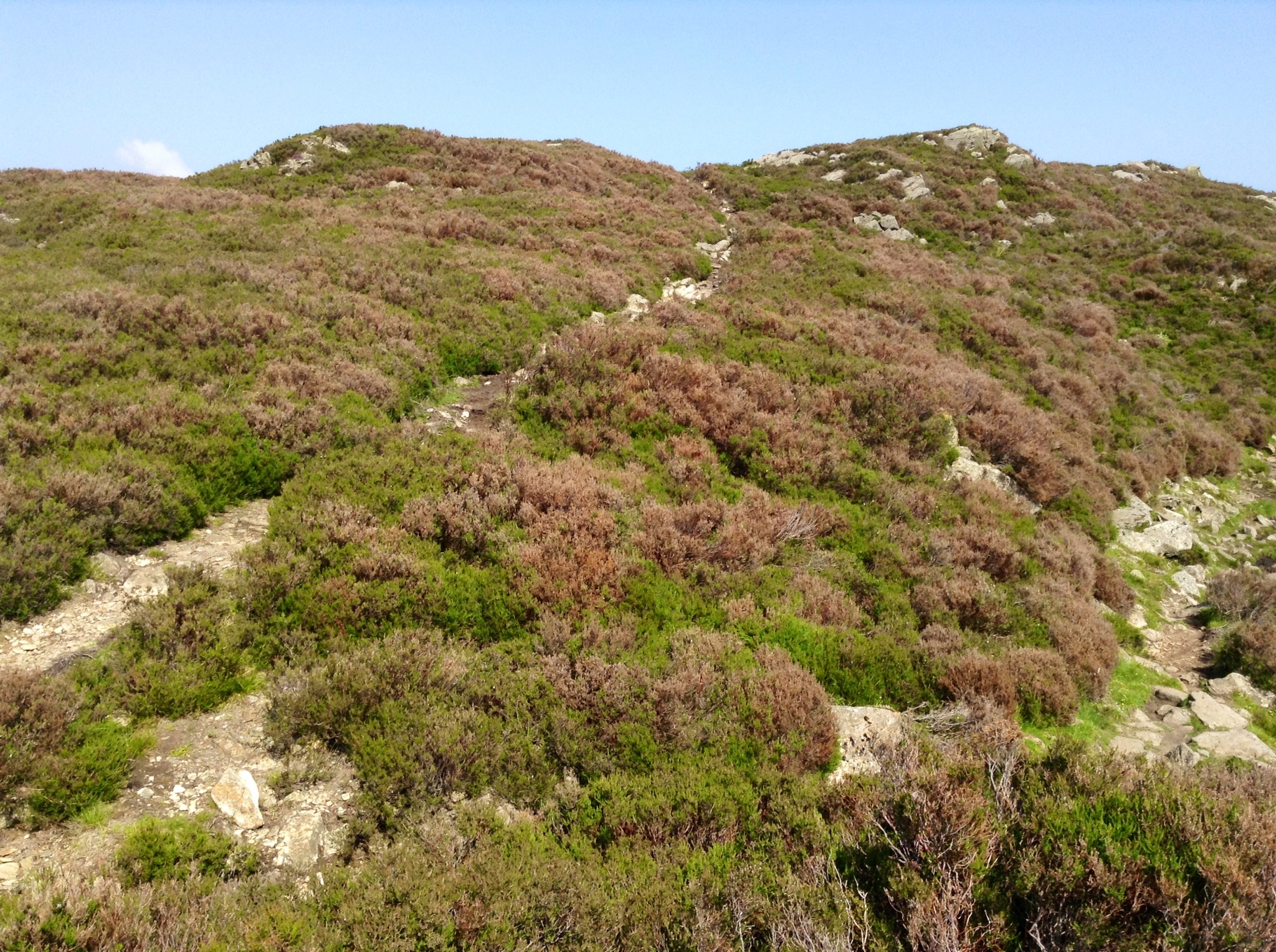
The path up where it looked like steps to the sky.
The really horrid parts of the climb I couldn’t photograph because I needed both hands on the rocks , or gripping my hiking poles, and my hands were so sweaty that the phone or iPad would smash its way down the rocks. No way I would venture down after them.
Standing on a more level spot – see the slope line to the right…the rocky path follows it down, down, down
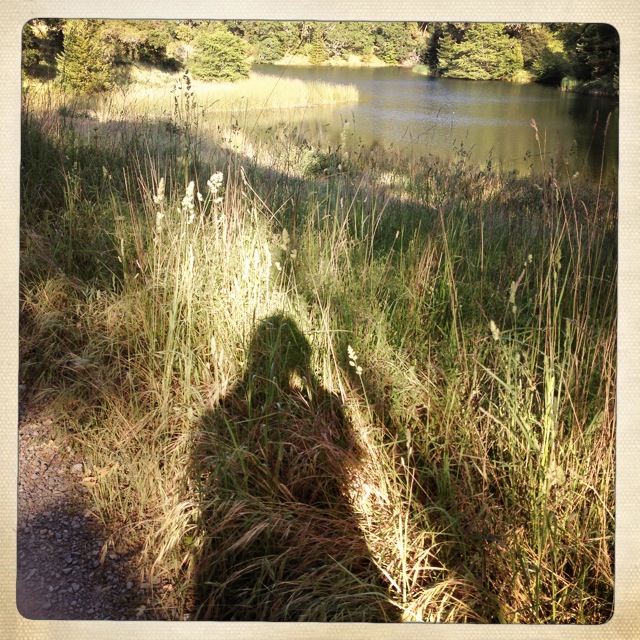
The view was really amazing. I took a moment to catch my breath and take a picture.
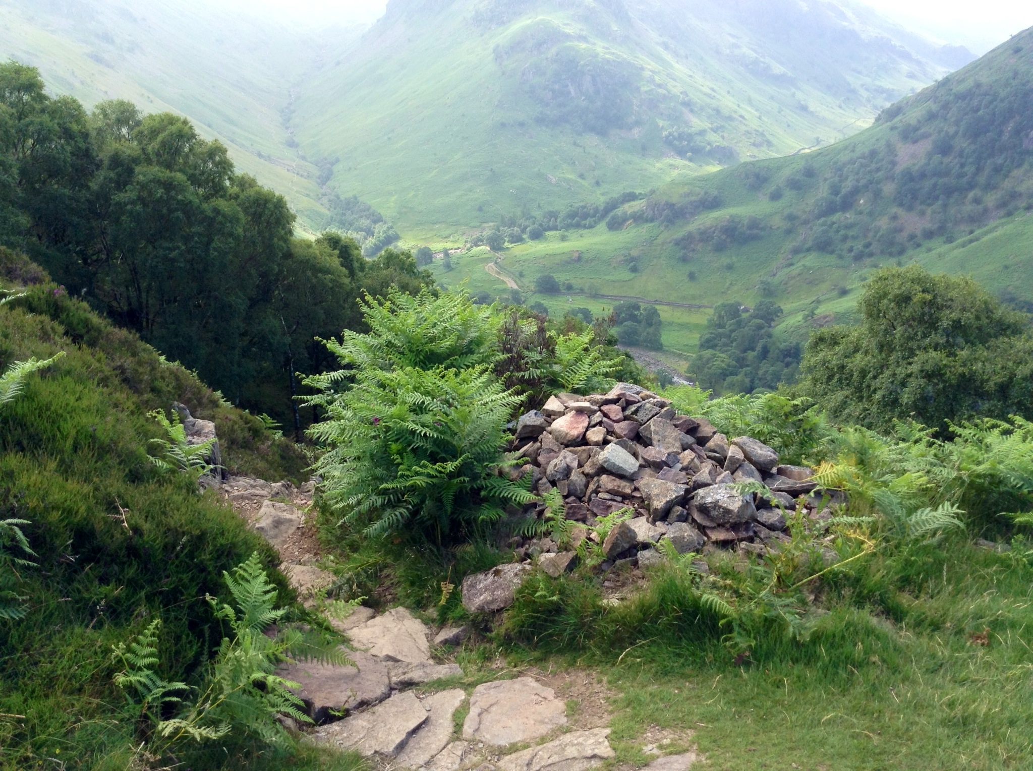
Climbing up from valley. Cairns mark the way, but here there was no other way, but up….unless you wanted to climb back from whence you came.
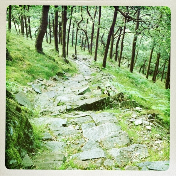
When we finally got to the end of these steps up, we followed a track that was rocky and boggy in parts and continued up.
The trail continues up on rocks in a marshy bog
It seemed after a hill crest you could walk a bit and the up you go again!
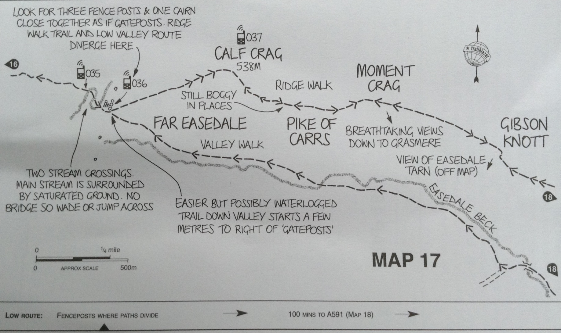
After climbing some more, we came upon a lovely water lily bedecked pond. We saw some hikers. When I told them we were going to Grasmere, they said that we had a really long walk ahead of us. I thought, oh well, maybe to them it is far. We should be close to 5 miles away at the most.
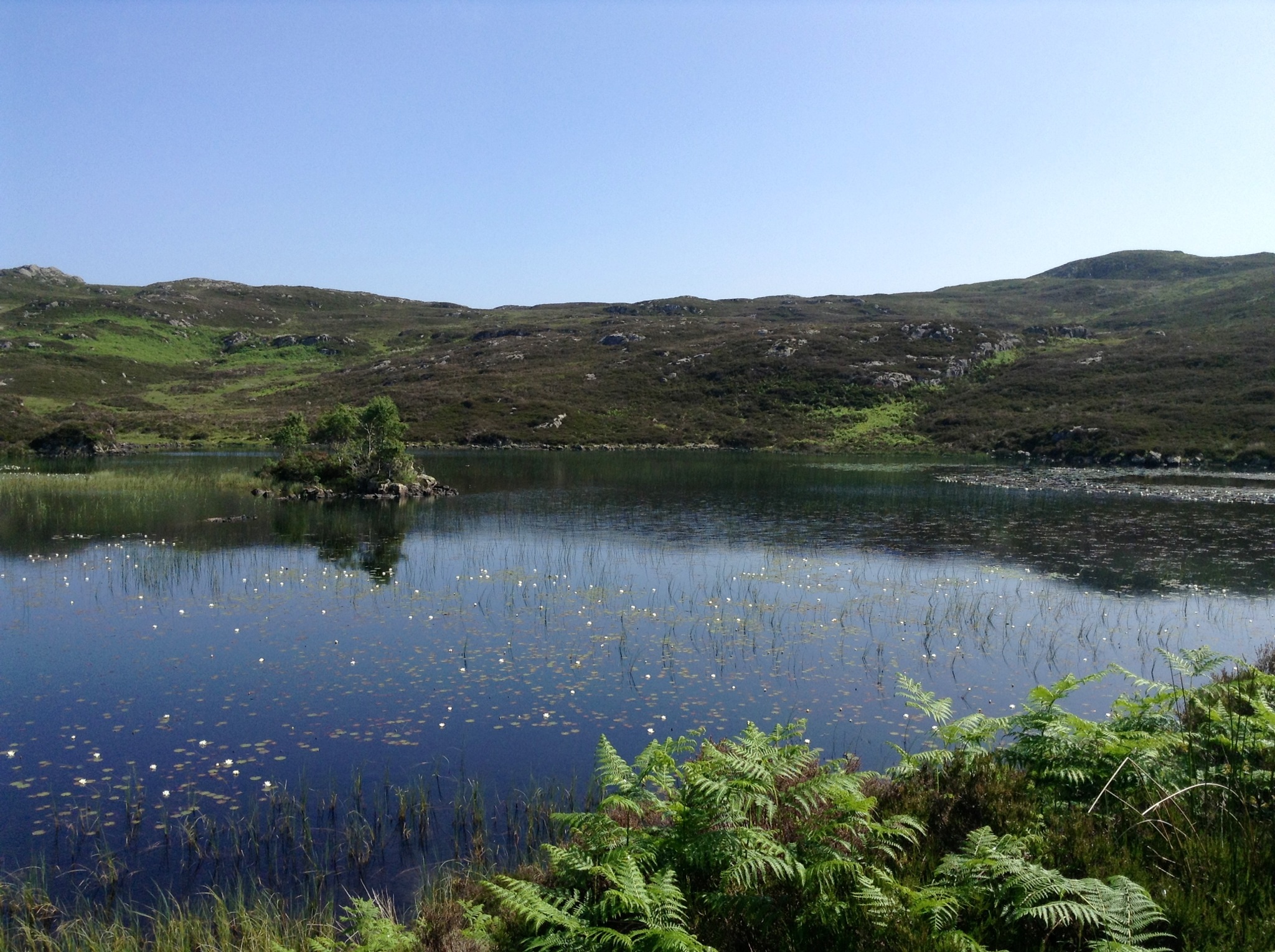
Lovely pond with water they they
They were heading to Landsdale and went on ahead. After some picture taking and water we followed the lone track ahead. The views were breathtaking.
Beautiful vistas
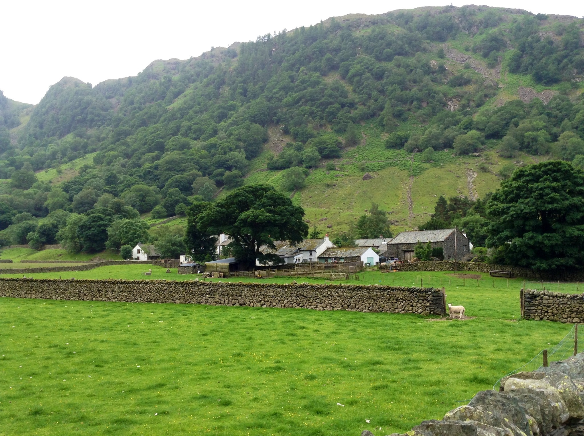
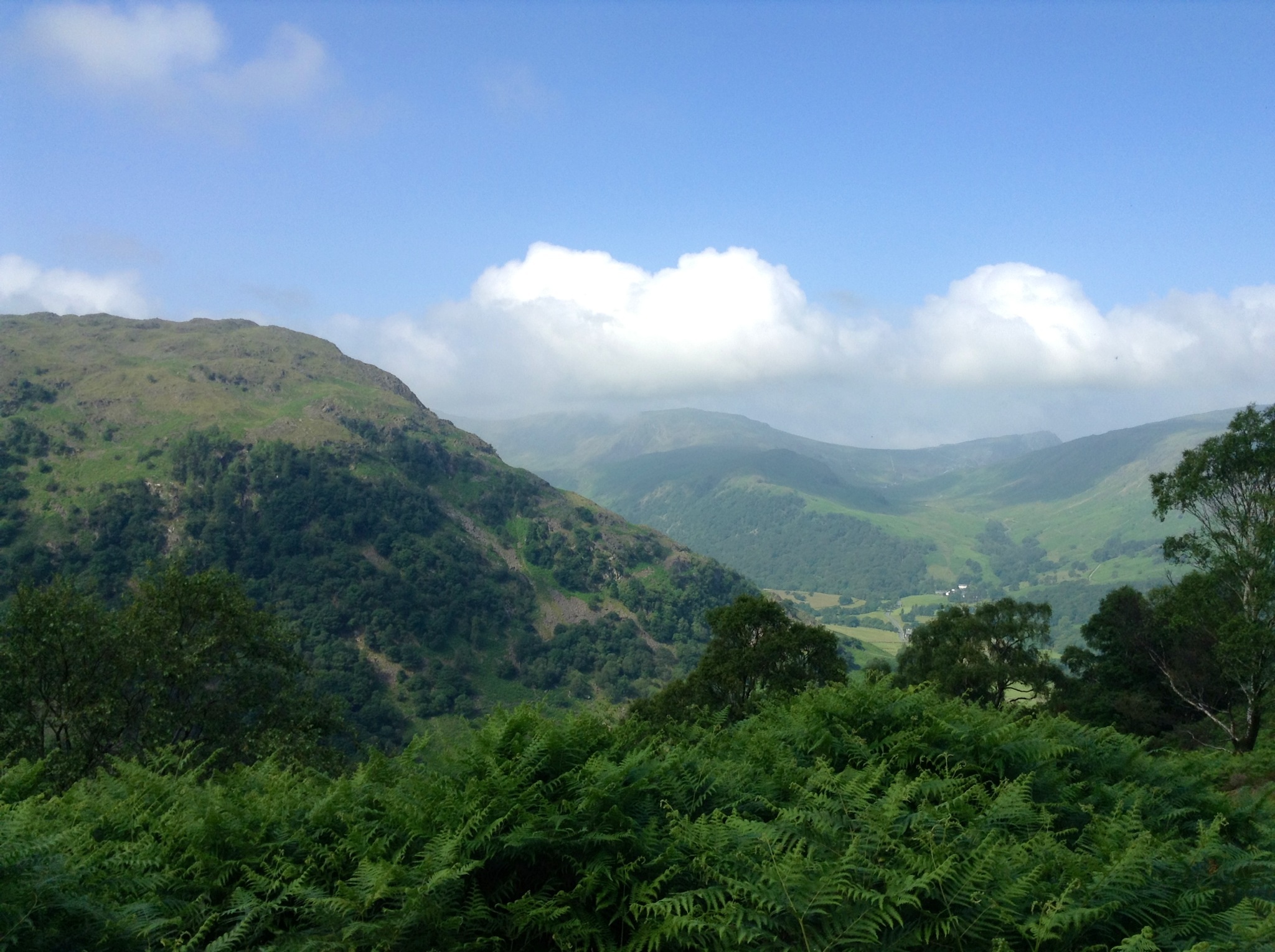
Eventually, the path seemed to descend. We were heading into a expansive green valley.

Pond/ lake in valley below with buildings
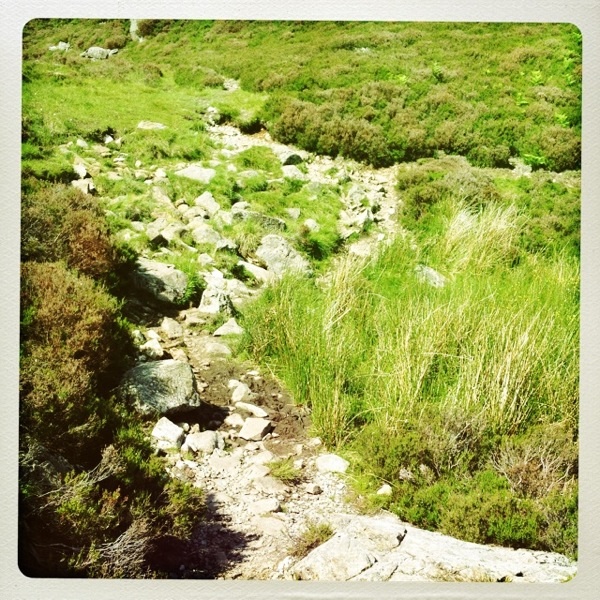
Again the path was rocky, marshy, and quite steep in some areas. My hiking poles have truly been a lifesaver. No picture can convey how quiet, peaceful, and lovely it was there.
Part of the path down
We met a few people walking up on day hikes and they told me there was a tea shop below. We headed there. It took a while, but we finally made it to the valley. I had a very nice toasted ham and cheese. Later I also got a fresh scone.
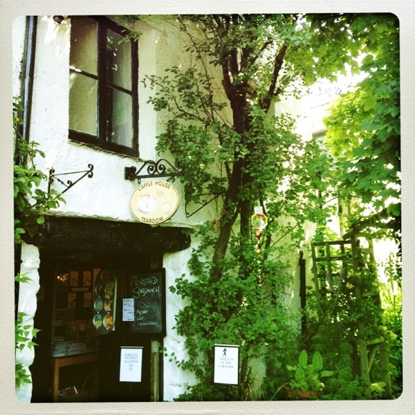
Tea room
The signs nearby said nothing about Grasmere, but gave directions to villages not on our route. I pulled out the maps and we couldn’t locate where we were. The brother and sister, fifth generation to have the Tea Shop, gave Tony some dreadful information. READ HIS COMMENTS.
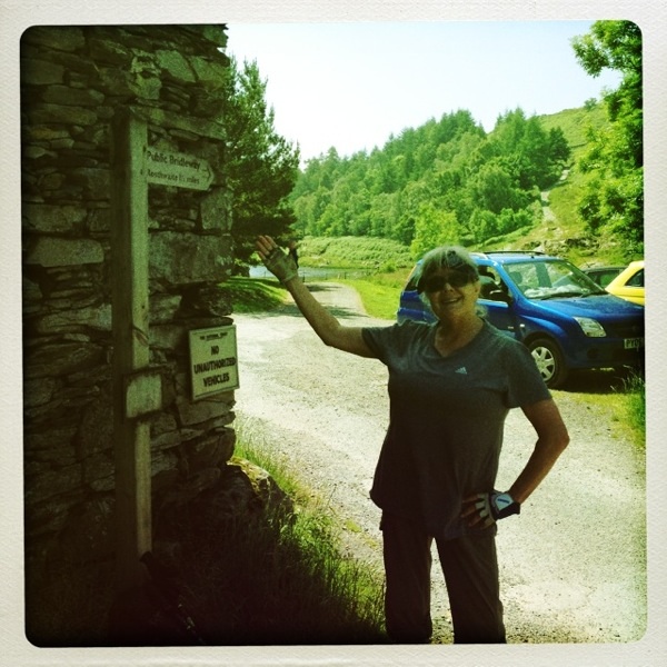
Mary by signpost at Watenlath which was literally the end of the road
As usual, Tony took a fine mess and turned it into a lovely outing. Susie our fabulous cab driver took us to some famous spots in the Wythburn Valley And local area.
We stopped at Surprise View and saw Lake Derwent.

Another stop at Ashness Bridge.
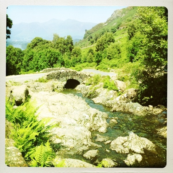
Ashness Bridge
Our last stop before we headed to the West View Inn in Grasmere was to Castlerigg Stone Circles Which are over 4,500 years old. The setting is brilliant with views of hills all the way around. We also got an ice cream from an ice cream truck parked by the side of the road.
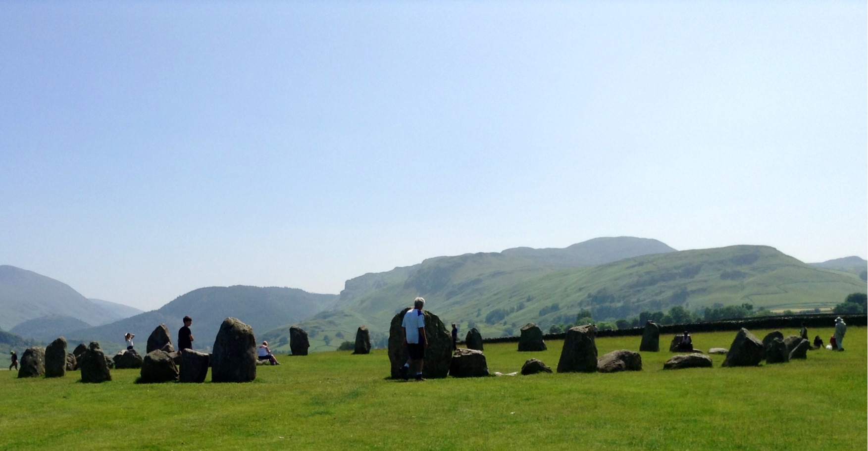
Castlerigg Stone Circle
We drove along narrow one lane roads. At one point we were on a farm lane and a tractor pulled out. We did not play chicken. The farmer backed up into the field.
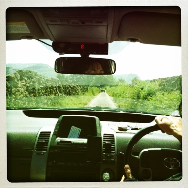
On the farm lane with Susie.
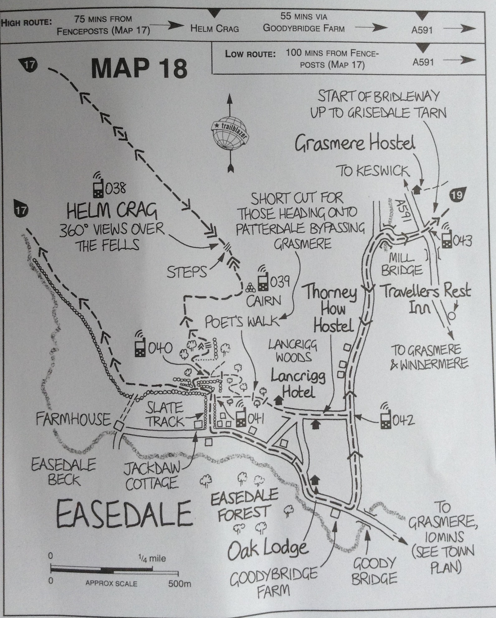
We arrived at our B & B tired and sweaty. We put in our miles, but not quite in the right direction. We had a delightful tour of the down, walk down the River Path, and ate a delicious dinner at a nearby hotel.

West View Inn in Grasmere with Tony
All’s well that ends well.
Nope. The Weak Link read the map and within minutes we were on a terror laced climb on slippery rock, bad steps and a potentially preciptous plunge, only to emerge onto a beautiful, if boggy, plateau, across which we hiked for an hour or so until we came to the end of the flat places (read yeterday’s comments) and started DOWN. A long way down. Nothing matched the map, we were three and a half hours into our hike, and had this descent for the next hour. Came to a charming little tea shop at the end o the hike, by a nice little pond. Had sandwiches and looke at our maps. It was also at the end of the road. Figuratively and literally.
Nothing matched. So I went to ask the guy at the desk how to get to Grasmere, and he replied, in very good Lakes District English (which means to say I had to ask him three times what he said and by the third time got half of it.) “Well, lessee, you have an eight mile hike over the hill (read ‘ cliff’) behind the house here and then go to blah, and turn at the pine tress and then garble, blur blog.” I nodded dumbly and asked him where we were. “Here,” he said, rather proudly, pointing to a place two steep ridges and TWO MILES over from where we had left four to four and a half hours before.
I said, “Do you know if there is a cab comes to this part of the end of the world?”
He smied, said sure, and half an hour later we were taken on a tour of Derwent Water, Ashness bridge, famed all over th North of England, and a famous Stonehenge like ring of sones (much smaller and just as symmetrical). Spectacular. We all had icecream cones and she drove us to our B n B some (about fifteen, by road) miles away, to Grasmere. We tried to tip Suzi our cab driver, who would have none of it and we hope, if The Weak Link pulls off another one, to have her or her like save us again.
We hiked the town, dined very well and prepared for another day of endless hiking interspersed with brief (and in some cases, hourlong) periods of terror.
The Weak Link
The Weak Link (sometimes the missing link)
As the Bard says, all’s well that ends well….and you got so much more in the bargain, including Suzi. Sounds like a wonderful misadventure, I wish you many more, just as delightful and serendipitous. Enjoy the journey, good friends.
Linda, I know you would love this walk. Much of it is way outside my comfort zone, but it is truly beautiful here in the Lake District. We are having fun on our adventures and misadventures.
Of Maps & Men.
Now we know who the real navigator should be.
Love you!
Read over today’s maps carefully. Need to take right hand path for easier way. We shall not tread into the unknown heights today!
Hmm, shorter route for a reason, I see! I think, perhaps, I should take an anti-anxiety pill before reading of your next adventures! My heart was pounding; I got cardio exercise just lying in bed reading such a suspenseful, scary bedtime story!
Mary, I think, when safely home again, U should draw some maps & U both could re-name the paths/trails (whatever) appropriately with your own notations…(& post future hikers BEWARE). ;-/ Nice pics, tho!! Fantastic scenery.
Wishing you, at day’s end, a “bucolic little village w/rustics” etc, etc 😉 & Divine Intervention (as with Susie) when needed, & sweet rewards for you labours.
Love, Melissa
Must say, Melissa, aside from the scary hikes, you would love it here. Every turn you make presents another beautiful vista. Sometimes the views are majestic mountains and high crags, and just as wonderful are the old stone barns and sheep field shining green in the afternoon sun. You wouldn’t know when to stop taking pictures. I can imagine you watercoloring the lovely scenery. Beatrix Potter Country indeed.
U R right, Mary. I wouldn’t know when to stop taking pictures…I’m enjoying yours…I zoom in on those I can & try to take a closer look at the fantastic rock work of fences, buildings, cairns & contemplate the lives of those who made them…Also the many shades of green; yellow flowers in fields, cute sheep, hay field, lovely farms, stupendous vistas-such grandeur! I would have to take “the road well travelled” by car & admire the beauty from below. Many good paintings could come from your photos. (I had a funny thought tho, imagining u doing some Diebenkorn-style paintings of the steep so-called “paths”). Some of those rocky, “hard to see” (hard to imagine) paths are mind boggling! More power to you, my friend. U R Amazing!!! Luv U, Melissa